Mud dances and track finding


So, we've made it to Te Kuiti. It took us a day longer than expected and we had some interesting trail adventures along the way. After leaving Hamilton we headed west towards the Karamu track. It was officially the coolest farmland we've walked through yet. Amazing views out towards the Coromandel, crazy rock formations and steep valleys. Those sheep just don't know how good they've got it. We came across a farmer docking lambs tails - those cute little lambs may get their tail chopped off but they're living in paradise.
We then headed up Mt Pirongia. At 959m it was the highest we've been so far. After walking uphill for about 3 hours on a fairly well maintained track, it all of a sudden turned into boot high mud, then for the last couple of kilometres wooden boardwalks started appearing out of nowhere, leading to a very fancy raised platform at the summit. Very civilised and totally unexpected. Even though it was only 4, we decided to cut our day short and stay at the Pahautea hut just past the summit. It was great to have some books to read, get out of the howling wind that has plagued us for days, plus we also didn't think we could make it out of the bush by dark - not a comforting thought on steep muddy trails with nowhere flat to pitch a tent. We did laugh at some of the comments about the mud in the hut book - 'mud mud mud', 'need more boardwalks! Too much mud!'. It seems as though a NZ track isn't really an NZ track without copious amounts of mud and having to perform fine balancing acts on top of mossy tree roots, submerged rocks and grassy tufts to avoid sinking in above your boot line. We actually though this track wasn't too bad.
After heading south on some closed trails - all the open ones went north which is a little counter-productive to our aim, we headed back into farmland. We had our first real adventure with getting lost, well, not totally lost because we knew exactly where we were, but the trail was another story. The track had started from the road with no sign but clear typical trail markers - orange triangles and painted styles. We easily followed that until we checked the GPS to find we were totally off track. Now the GPS has been great and so far had been totally accurate. We decided to bushwack up a steep ponga covered hillside to find the trail that was supposedly 83m away. After wrestling with vines and grabbing onto rotten ponga trucks that snapped off under your weight, we came to the site where the trail was meant to be, but there was no sign of it. After searching around for a while we decided to head back to the last trail marker we'd seen and see if we'd missed anything. After a couple of hours of walking in circles, trying to find alternate routes out of very isolated and hilly countryside we finally figured out that the co-ordinates of the route on the GPS wasn't placed properly so we were actually running parallel to the track we wanted the whole time. We struggled back, found a subtle entrance to another trail that we'd missed earlier and finally started making some positive progress again. The weird thing was that at the end of the trail the markers started up again. Someone had obviously gone through and taken out the whole middle section of markers, a disgruntled farmer? We're not sure.
Now we're having a rest day in the sun in Te Kuiti before heading off on a 10 day section over some high mountain passes to Ohakune. It might be a while before you hear from us again.
Alice
Pictures:
Sheep on horizon
Farmer herding Sheep
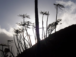
Ponga Silhouette
Us on the summit of Pirongia
Dennis and Lane at the Pahautea hut